ARADCOM

Detroit - Cleveland
Defense Area
ARADCOM |
|
Detroit - Cleveland Defense Area |
| Unit: | 1/55 - 9/58, HHB, 504th USA 1957 - 9/58, Battery B, 504th USA 9/58 - 2/63, HHB, 2nd Battalion, 517th USA 9/58 - 2/63, Battery B, 2nd Battalion, 517th USA |
| Activation Date: | January 1955 |
| De-activation Date: | February 1963 |
| IFC Area: | South side of Newport Road West of Telegraph Rd east of D-58
IFC. GPS: +42° 00' 19", -83° 21' 25" |
| Launch Area: |
Southwest of D-57/58 IFC in middle of fields. |
| Radar(s): | LOPAR |
| Missiles: | 30 Ajax |
| Magazine(s): | 3 type B |
| Launchers: | 12 Ajax |
| Current Status: | The IFC is partially intact. The Radar towers, Generator bldg., Van pads, and connecting building foundation are all there. This IFC and the D-58 IFC shared the same Launcher Area which is still there. The Pits have been demolished but the Barracks, Guard Shack, Warhead Bldg., Assembly & Test bldg., Generator bldg. and a bunch of blast deflectors still remain. All the Launcher Area buildings have been trashed by vandals as it's in a secluded area. The Admin Area still remains with the Admin building, Barracks/Mess hall, Theater, and some storage buildings remaining. The Housing area is also still there and is now civilian homes. |
| Comments: | The whole site; Launcher, IFC and Admin areas used to be the Newport Naval Air station which was used in WWII for pilot training. The Launcher Barracks was erected in the area that used to be the airfield. This was a Shared Double Launcher Area with separate IFC's. |
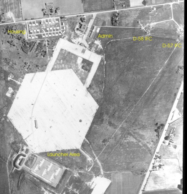
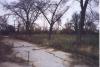
D-57/58 as seen in 1961. The road to the East is Telegraph Rd. and the road to the North is Newport Rd.
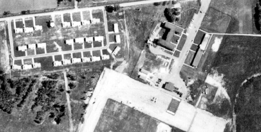
D-57/58 Administration and Housing as seen in 1961.
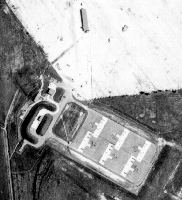
D-57/58 Launch area as seen in 1961.
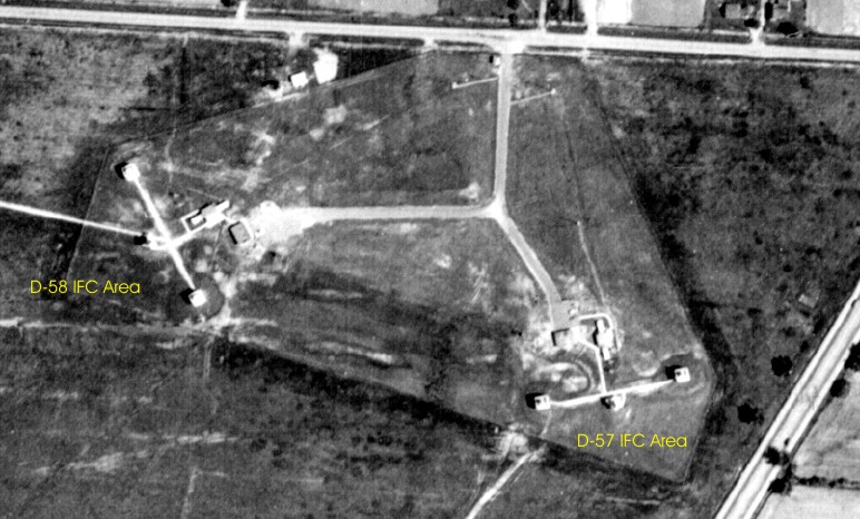
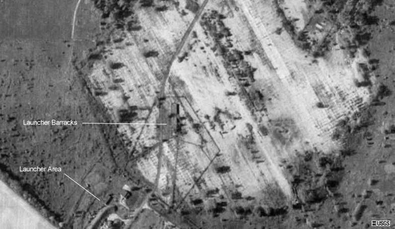
D57 and D-58 IFC areas as seen in 1961.
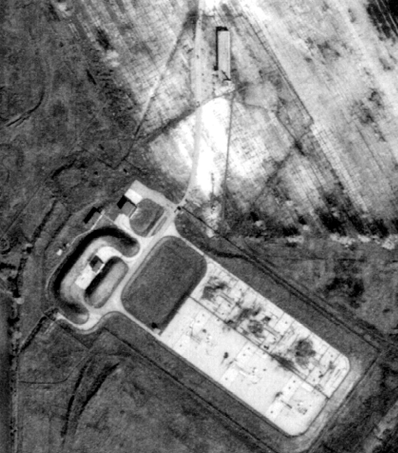
D-57/58 Launch area as seen in 1981. Note the vegitation growing over half of the pits (D-57).
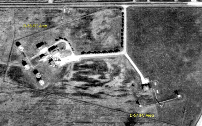
The D-57 and D-58 IFC areas as seen in 1981.
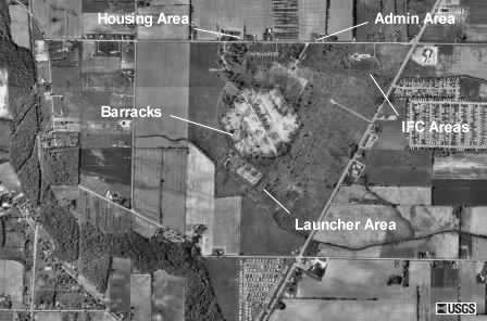
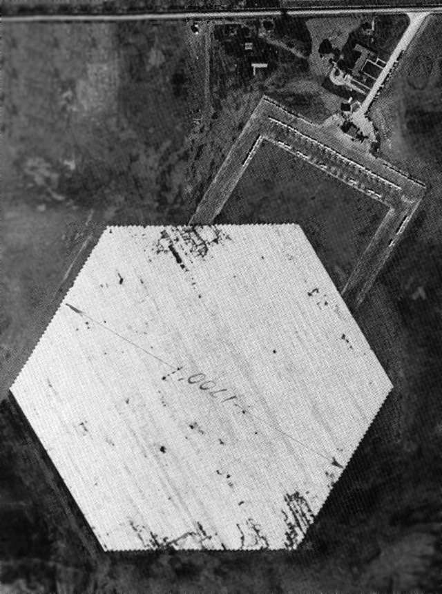
These images are from the Microsoft TerraServer and were taken in 1993. The six sided area is the barracks area for the Launch area. The Launcher area is just south of it. The IFC area is NE of it.
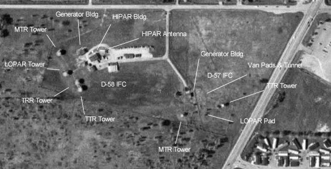
This is the IFC area as seen from above. The site is partially intact with various buildings still standing including the 2 radar towers.
This was the Launcher Barracks. The area was originally the airfield for the Newport Naval Air Station during WWII.
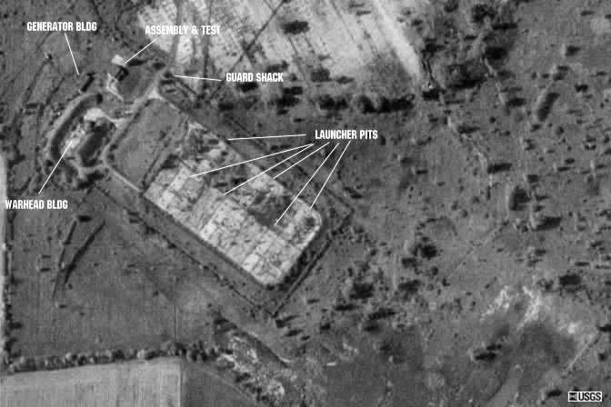
This is the shared Launcher area for D-57/58.. The site is partially intact with various buildings still standing. To the north of the Launcher area (the light colored area) was the Barracks (used to be the runways for the Newport Naval Air Station during WWII). The Magazines have been demolished since this picture was taken. The southern pits faced east and the northern pits faced west.
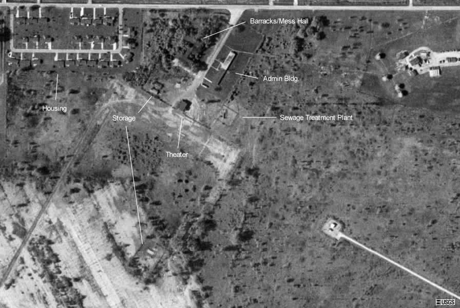
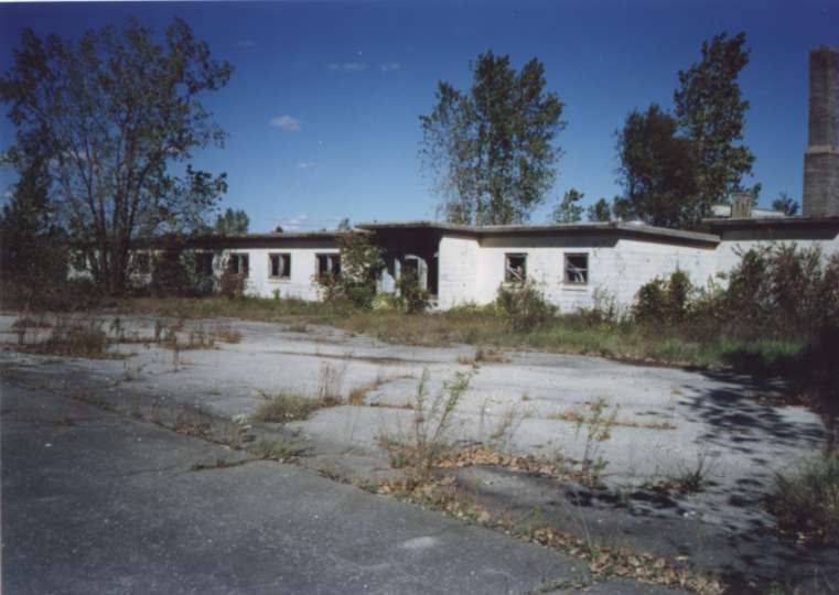
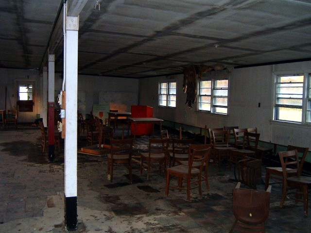
This was the D-57/58 Administration Area. It was originally the Newport Naval Air Station during WWII. The Barracks building was also used to hold German POW's from 1945 to 1946. The Theater was originally an Aircraft Hanger. The Admin Building was originally the Air Station offices and carpentry shop.
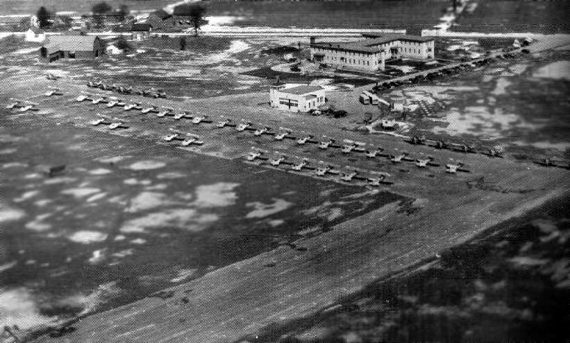 |
Newport Naval Air Station sometime during WWII. In this photo you can see the original barracks building at the top of the photo and the Hanger (later the base theatre) just below it. |
 |
An overhead view showing the landing field along with the detail from the above photo. |
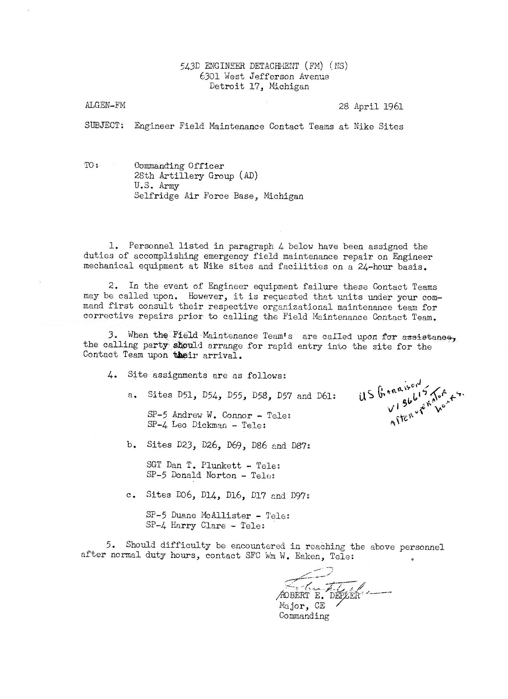 |
Memo documenting the personnel assignments for Emergency Equipment Maintenance for all Detroit Nike Sites. Contributed by Linda Klais. 395k |
 |
This is where the Guard Shack for the Administration Area used to be. You can see the Admin building in the background. |
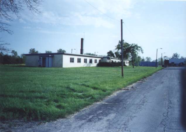 |
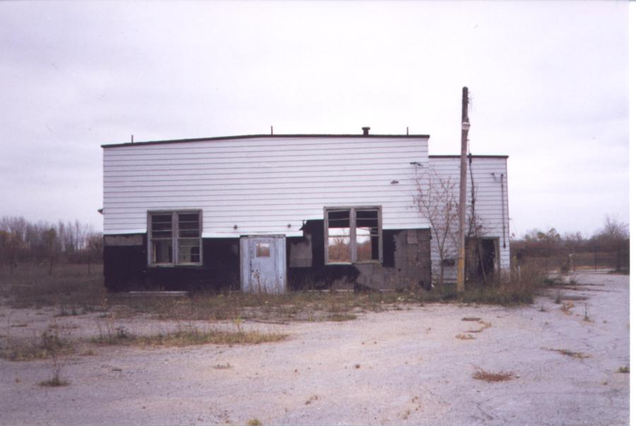
The Admin Building. This building appears to be in very good shape. |
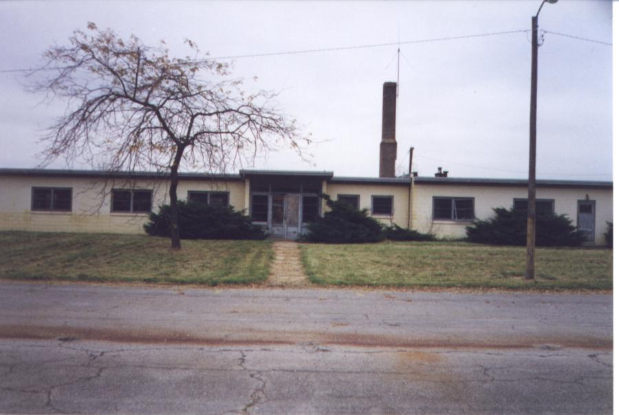 |
Another picture of the Admin building. |
 |
This area (across from the Admin. building) is where the old WWII enlisted barracks used to be. The building was used as a German Prisoner-of-War facility during WWII. |
 |
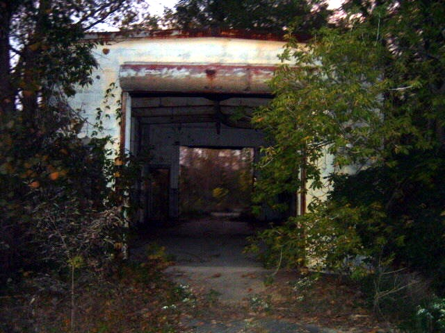
This building was originally an Aircraft Hanger when the facility was a Naval Air Facility. It was used as the base Movie Theater during the Nike Era. This picture is looking south. The building has been condemed as it is very unstable. |
 |
Here is the Movie Theater looking North. |
 |
TTR and MTR radar towers. |
 |
The Generator building. |
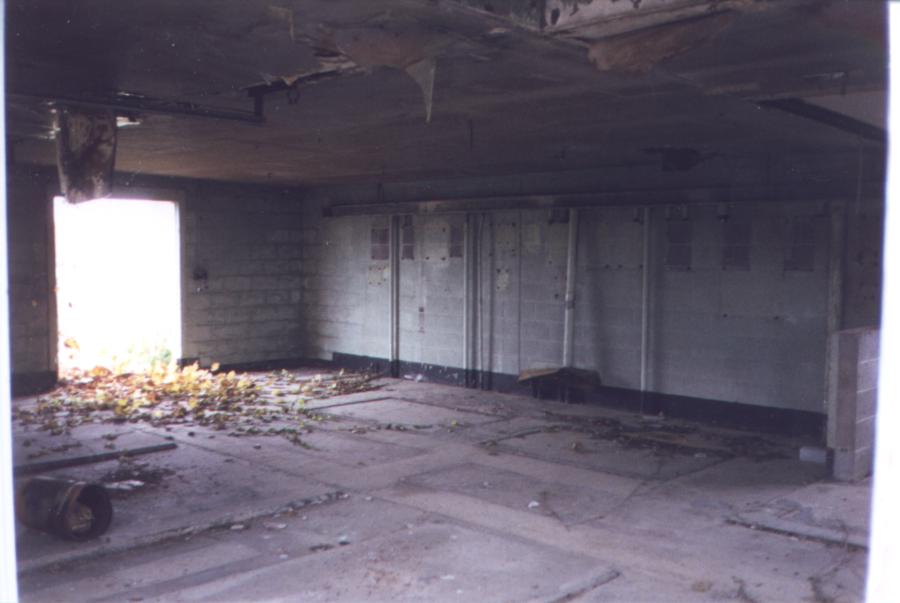 |
This a picture of the interior of the Generator building. You can see the concrere pads where the generators were mounted. |
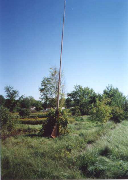 |
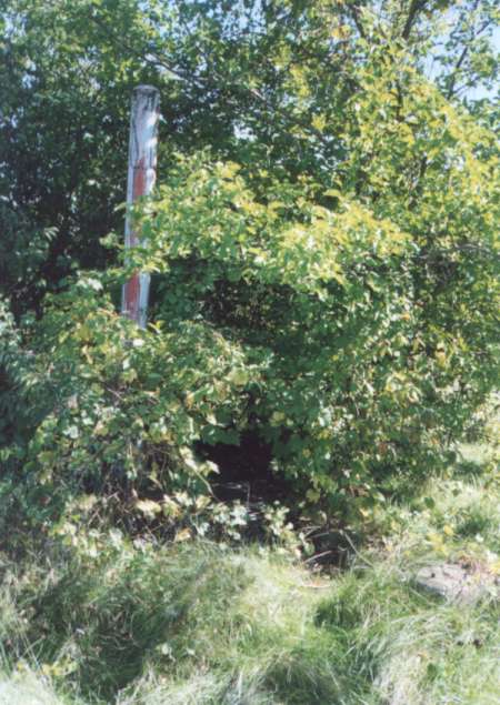
There are 2 of these unidentifiable devices at the IFC. They are a segmented pole about 15 feet long with a 90 degree metal arc on the end. The pole is mounted to a bracket that allows the pole to be raised and lowered at the pivot point. Tom Palinko has identified this device as a Lightning Arrestor to protected the Vans from strikes during storms. There was a pole located in front of each control van. I read that strikes were a real concern, as the vans had a high magnesium content and would really burn! Thanks for the info Tom! |
 |
Here is another picture of the "pivoting pole" device. I have a picture of the CL-02 site which shows one of these. In that picture it looks like a radio antenna as there are wires visible on the bottom of the pole. Please see the previous picture for an explanation of the device. |
 |
Here is a picture of one of the Van Pads. I was standing where the Interconnecting Corridor was when I took this picture. |
 |
It's hard to make out, but this was the LOPAR Radar mounting pad. A 20 foot high, triangular steel scaffold was installed using the concrete pads as mounting points. A large octagonal platform was on top of the scaffold. The LOPAR was placed on this platform. |
 |
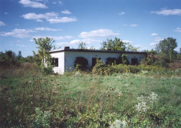
The Barracks. The building has been trashed pretty badly. |
 |
A sign painted on the road in front of the Launcher Area gate. It says "DEPOSIT FLAME PRODUCING ITEMS HERE" with the line pointing to the side of the road. |
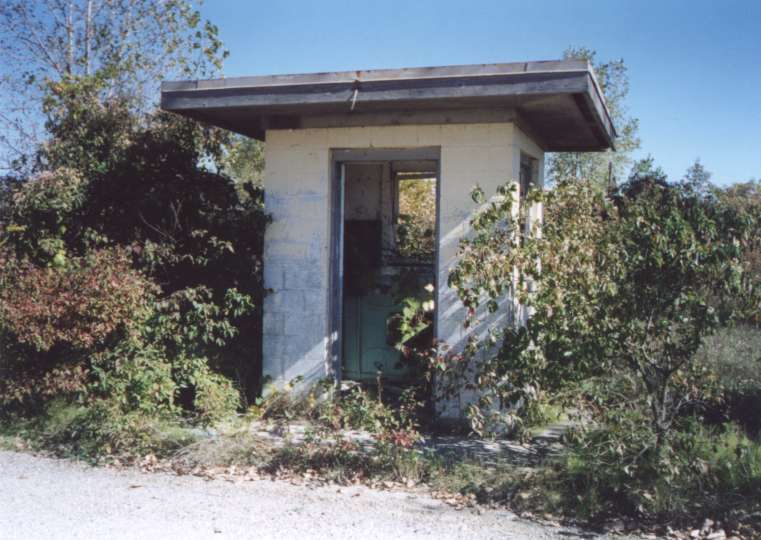 |
The Guard Shack at the gate to the Launcher Area. |
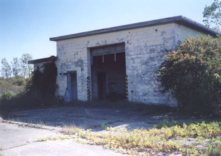 |
The Missile Test & Assembly Building. |
 |
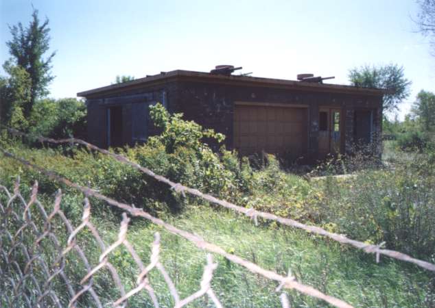
The Launcher Area Generator Building. |
 |
Another picture of the Launcher Area Generator Building |
 |
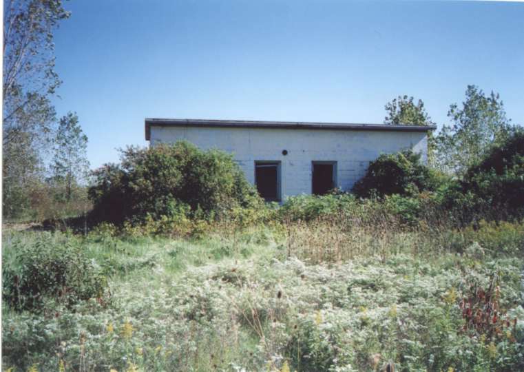
This was the Warhead Building. |
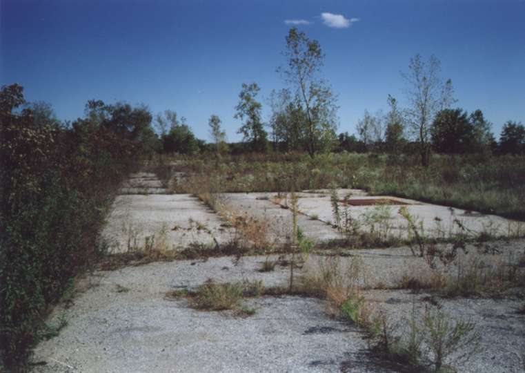 |
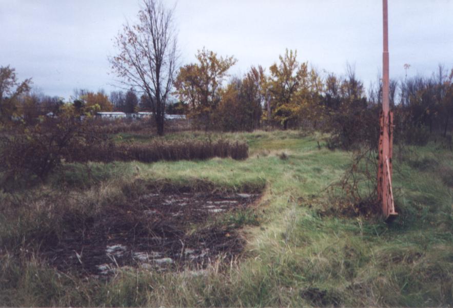
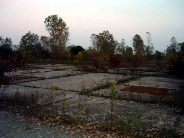
This is what is left of the 6 "B" type Magazines that made up the D-57/D-58 Launcher Area. |
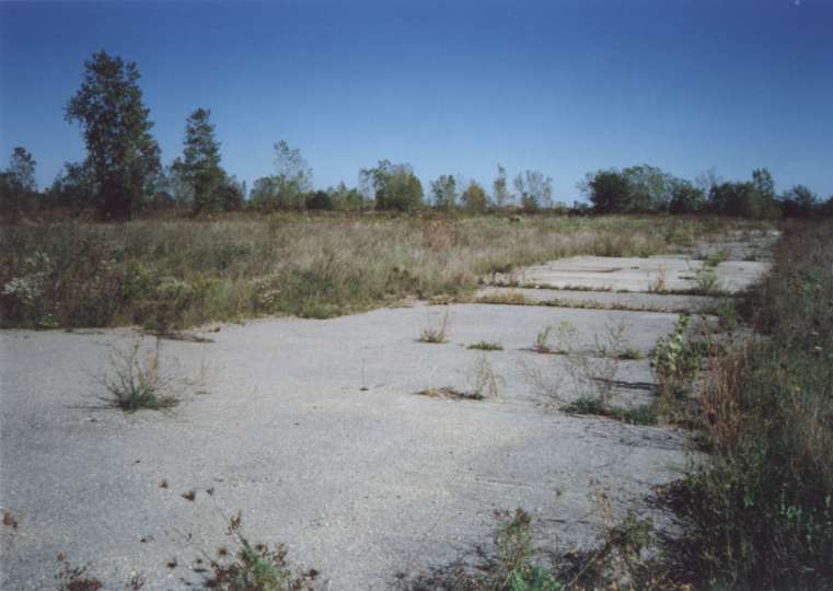
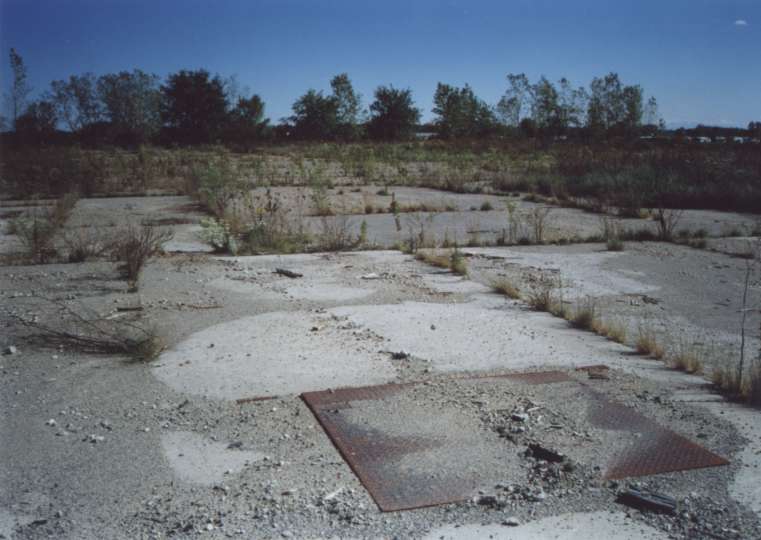 |
Another picture of the Launcher Area. |
 |
You can't make it out in this picture, but in the distance are the cooling towers of the Fermi Nuclear Plant which was built about 5 miles away from the site. |
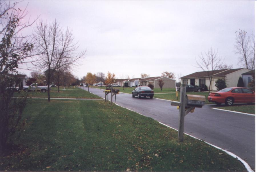 |
This is a picture of what was base housing. It is now a small subdivision bordering the area of the old base. |
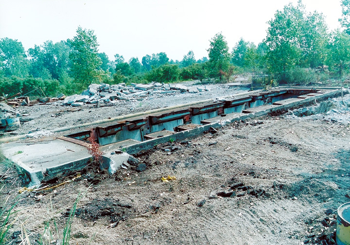 |
DERP FUDS site cleanup at Newport. Missile silo structure being demolished at former D 57/58 in Newport, MI. Photo taken 22AUG1996 - Army Corps of Engineers. |
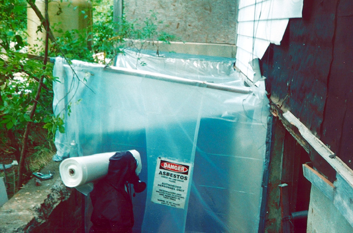 |
DERP FUDS site cleanup at Newport. Asbestos abatement (mechanical room) at former D 57/58 in Newport, MI. Photo taken 31OCT1996 - Army Corps of Engineers. |
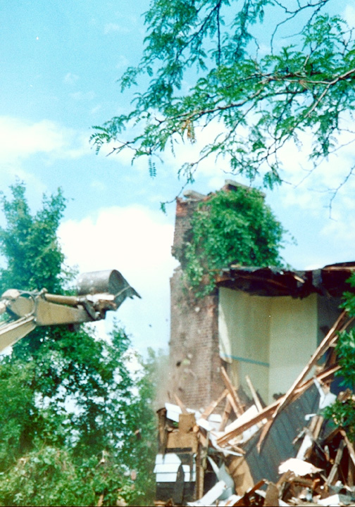 |
DERP FUDS site cleanup at Newport. Demolition of mess hall at former D 57/58 in Newport, MI. Photo taken 31OCT1996 - Army Corps of Engineers. |
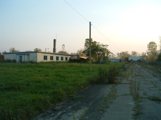 |
Fall 2007 - Just inside Main Gate. The building on the left is the Administration Building, the building ahead is the Theater, (really delapidated and nearly falling down.) and the blue thing is a shipping container. Deer ran out in front of me when I was about even with the shipping container. Contributed by Jeff Kroll. |
 |
Fall 2007 - This is a picture of the room just to the left
of the main entrance to the Administration Building, which is the room with
the Nike insignia on the door in the middle (the door with the Nike Insignia is a bathroom). Contributed by Jeff Kroll. |
 |
Fall 2007 - This picture was taken from the doorway to the left of the door in the previous picture. It looked to me like the room may have been converted into a messhall. Contributed by Jeff Kroll. |
 |
Fall 2007 - This is a picture of the hallway in the other half of the
building. The Administration Building is divided in half with a wall |
 |
Fall 2007 - This picture of the Warhead building is pretty self explanitory. Note the differance in vegitation from the 1998 photo. The building is almost completely over grown now. The lighting effect in this photo is interesting. It makes it look rendered I think, but it's real I assure you. The inside of the building has been hit by a lot of vandalism, and one of the panels is all shot up.. Contributed by Jeff Kroll. |
 |
Fall 2007 - Nike Launch Pits. Contributed by Jeff Kroll. |
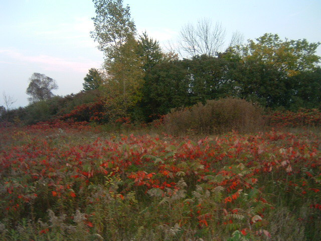 |
Fall 2007 - Field behind Pits. Contributed by Jeff Kroll. |
 |
Fall 2007 - Fallen light in front of Admin building. Contributed by Jeff Kroll. |
Formerly Used Defense Sites Public Geographic Information System
| Property Name: |
NIKE D57/58, NEWPORT |
|||||
| Latitude: | 42° 0' 20" N | 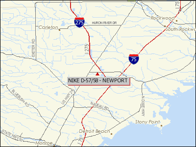 |
||||
| Longitude: | 83° 20' 35" W | |||||
| City: | NEWPORT | |||||
| County: | MONROE | |||||
| State: | MI | |||||
| Corps Geographic Office: | Louisville District (LRL) | |||||
| Point of Contact: | LRL Public Affairs Office | |||||
| Public Affairs Office Phone Number: |
502-315-6766 | |||||
| Status on National Priorities List: |
Not Listed | |||||
| EPA Region: | 5 | |||||
| Congressional District: | 15 | |||||
| Restoration Advisory Board Available: |
No | |||||
|
|
||||||
| Currently known as the Frenchtown Commons Condominiums, the Wellington Loh property, and the Michigan National Guard training facility. The former DOD installation was 480.72 acres and was obtained in 1942. The site was initially used by the Navy for pilot training. In 1956, the entire site was transferred to the Army for use as Nike Battery D-57/58. Monroe County converted an 84-acre portion into Nike Park. The Michigan National Guards 35.8 acres is currently the only portion of the former site that is still owned by the Army. A small area is owned by the FAA. The rest of the property is in private hands. | ||||||
|
|
||||||
| The site consisted of 480.72 acres. Most of the site D-57/58 was sold to a private owner in the mid-1980s. A portion of the site is currently owned by the State of Michigan and is used by the Michigan Army National Guard. | ||||||
| Current Ownership Types(s): PRIVATE; STATE | ||||||
| Cost to Complete (thousands): $2519.97 | ||||||
(Information courtesy of Mike Denja)
Jeff Kroll writes:
"I was on your page about the D-58 Carleton Nike site, and thought I'de mention that I was out there recently, and took some pictures includeing the interior of the Admn Building, I ran out of memory o my camera, anyway I can send them to you if you want to post them. The site is much more overgrown than in your 1998 photos, almost the entire concrete landing field for the old Airbase is completely overgrown, and is now relatively heavy forest, what concrete remains exposed has broken down into gravel. All the buildings that were there in 1998 are still there now, but the vandals are really starting to take there toll, and the vegitation in the Launcher area is so heavy it's disorienting it's like walking through a jungle, it took me a good 15 minutes or so to find the Launcher pit area, and I was standing right at the Warhead building. The Warhead building is almost entirely obscured by trees, and the Nile generator building while visibal is so over grown you would almost need a Matcheti to get inside. Several of the buildings are pock marked by bullets, and I ran accross a shotgun husk, the Missile Test, and Assembly Building has been hit hardest by the vandals, but the whole Luncher area has been hit pretty hard, and theve smashed all the windows in the Admin building, knocked down a lightpole outside, and there tearing down the cieling it's really sad to see the dmage there doing there. :( The Area appears to be in use by local ATVers judging by the tracks, and the one that I saw following me when I was on my way out, and I assume it was them who knocked the South Eastern Corner of the Fence down in the Nike Area. The whole area is teeming with wildlife now, 3 white tail deer jumped right out in front of me by the Admin Building not even 25 yards away, and rabits, and birds abound, the noises they make make exploreing, particularly inside the buildings a little nerve racking. The Army appears to have just up, and left as the buildings were still fully furnished, although the vandals have done a number on the furniture, and theres a large stack of field manuals in the Admin building, for what looks like an Obsolete piece of Radio Equipment. The Admin Building appears to have been converted into a barrcks, as almost all of the what I assume to have been offices had beds in them. The site does not appear to be in use by the national Guard, or anyone else for that matter, and the main gate was open, and there were no signs posted that said keep out, so it appears to be completely abandoned."
| Rank | Name | Assignment | Dates |
|---|---|---|---|
| Phillip Hewitt | Warhead Technician | 2/69 - 1/70 | |
| Louis Peyton | Launcher Crewman | 1957 - 1960 |
This page was last updated on
01/21/2020
.
© 1998 - 2025 T. Bateman